Google Earth has revolutionized the way we explore and navigate our planet, offering a virtual window to almost any location on Earth. Whether you’re planning a trip, conducting research, or simply satisfying your curiosity, Google Earth provides a remarkable platform for immersive exploration. However, it’s critical to comprehend how frequently Google Earth changes its data to guarantee the authenticity and applicability of the information displayed. In this article, we’ll examine the variables affecting how frequently updates occur, highlight recent improvements, and show you how to keep abreast of the most recent updates.
Google Earth Update 2024
Updates to Google Earth include a variety of enhancements, such as new 3D models, updated data from multiple sources, and satellite imagery that has been updated. Regular updates are necessary to preserve the platform’s content’s accuracy, provide new features, and reflect how rapidly our world is evolving.
Factors Influencing Google Earth Updates:
- Technology Developments and Data Acquisition Techniques: Google Earth benefits from developments in satellite and aerial photography technology, including higher-resolution sensors and improved data processing methods. These developments make it possible to capture and incorporate more recent, accurate imagery into the platform.
- Availability of Satellite Imagery and Aerial Photography: The availability of satellite imagery and aerial photography plays a significant role in determining the frequency of updates. Google Earth relies on partnerships with satellite operators and aerial imagery providers to access the necessary data. The availability and coverage of these sources influence the frequency of updates for different regions.
- Partnerships with Data Providers: To acquire a wide range of datasets, Google Earth works with many data suppliers, such as governmental bodies, academic institutions, and commercial businesses. Through these collaborations, the platform may more easily incorporate the most recent data on topography, landmarks, roads, and other geographic aspects.
- User Contributions and Feedback: Google Earth values user contributions and feedback to improve its data accuracy and coverage. Users can contribute to the platform through initiatives like Google’s “Geo for Good” program, where volunteers can share their local knowledge, help validate data, and contribute to community mapping efforts. User feedback also assists in identifying areas that require updates or corrections.
Frequency of Google Earth Updates:
- General Update Schedule and Intervals: Google Earth does not follow a rigid update schedule, as the frequency varies based on multiple factors. However, Google strives to update its imagery and data on a regular basis, ensuring that users have access to the most recent information.
- Differences in Update Frequency between Satellite Imagery and 3D Models: Compared to 3D models, satellite imagery often gets updated more frequently. While generating precise and comprehensive 3D models involves more time and resources, the gathering and processing of satellite images is very simple and can be updated more regularly.
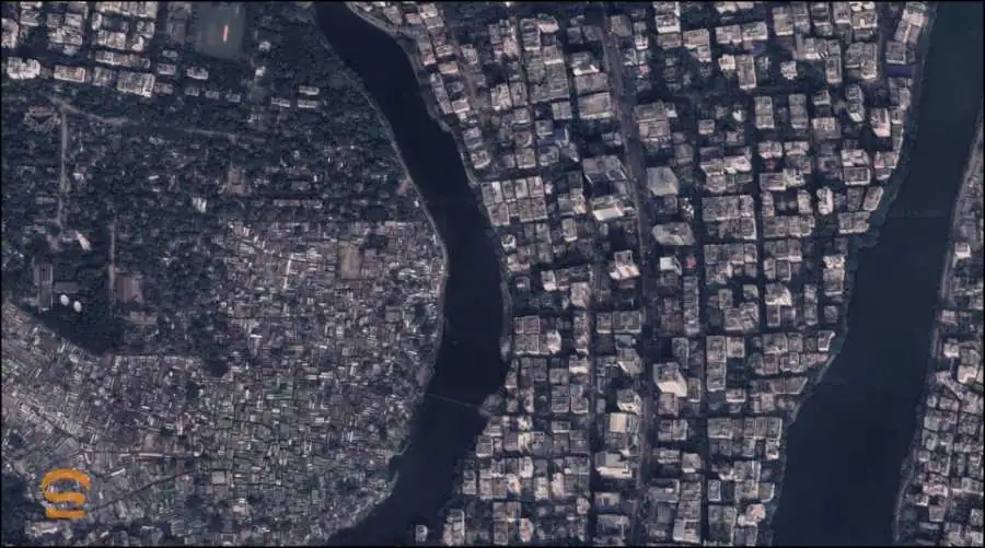
- Regional Variations and Priority Areas: The frequency of updates can vary between regions, with areas of high interest or strategic importance often receiving more frequent updates. Highly populated cities, tourist destinations, and areas experiencing significant development or change are usually prioritized for updates.
- Impact of Major Events and Developments on Update Frequency: Major events like natural disasters, urban expansions, or infrastructure projects can prompt Google Earth to expedite updates in affected areas. The platform strives to provide the most current and relevant information to users, particularly during times of significant change.
Enhancements in Recent Updates:
Google Earth continually introduces new features and functionalities to enhance user experiences. In recent updates, notable enhancements have included improved 3D rendering, enhanced Street View imagery, and the integration of new data layers. Additionally, Google Earth has expanded its coverage of historical imagery, enabling users to explore the changes that have occurred over time.
How to Check the Latest Updates of Google Earth:
- Exploring the “Imagery Date” Feature in Google Earth: Users of Google Earth can view the date of the imagery displayed for a particular location using the “Imagery Date” option. Users can check the satellite imagery’s freshness and see whether more recent updates are available by turning on this feature.
- Utilizing Google’s Official Announcements and Blog Posts: About new features, data additions, and platform upgrades, Google routinely releases announcements and updates. Users can stay up to date on the most recent changes and advancements by following Google’s official channels, including the Google Earth Blog and social media sites.
- Third-Party Websites and Tools for Tracking Updates: Several third-party websites and tools specialize in tracking and documenting the updates in Google Earth. These resources often provide detailed information about recent updates, highlight significant changes, and offer insights into upcoming developments.
Conclusion
For Google Earth to remain accurate, current, and effective, frequent updates are essential. Google Earth works to give customers the most recent and immersive experience possible through collaborations with data suppliers, technological improvements, and user contributions. Google Earth continues to develop and improve its platform, while the frequency of updates may vary depending on elements including technology improvements, the availability of data, and regional priorities. So keep exploring, be educated, and enjoy using Google Earth to learn about the ever-evolving landscapes of our planet.
Exploring the Past with Google Earth Historical Imagery on Android
Technology has made it possible to explore and discover a whole new universe in the digital era. Google Earth is one such product that has fundamentally changed how we perceive and comprehend the planet. Google Earth gives us the ability to move across different destinations while taking in the beauty and diversity of our planet thanks to its extensive collection of satellite imagery and aerial pictures. The ability to go back in time and discover how locations have changed through time is what makes Google Earth’s historical imagery feature even more fascinating. In this blog post, we will delve into the world of Google Earth historical imagery on Android and discover how it can transport us to the past.
Understanding Google Earth Historical Imagery
Before we go into the details, let’s take a quick look at Google Earth and its capabilities. With the help of satellite photos, aerial photography, and geographic data, Google Earth is a potent program that presents a virtual view of the Earth. Users may zoom in to street-level views, examine sites from different angles, and, with the addition of historical imagery, see how our world has changed through time.
- What is Google Earth Historical Imagery?
Google Earth historical imagery refers to the collection of past satellite and aerial images that have been captured over time. These images document the changes that have occurred in various locations, showcasing everything from urban development to environmental transformations. - Significance and Benefits of Exploring Historical Imagery:
The ability to access historical imagery holds immense value for a wide range of purposes:
- Researchers and scientists can study environmental changes and analyze their impact.
- Historians can trace the evolution of cities and landmarks, uncovering hidden stories and cultural heritage.
- Educators can enhance geography and history lessons with visual evidence of changes over time.
- Individuals can explore their ancestral roots, and local history, and engage in virtual time travel.
Accessing Google Earth Historical Imagery on Android
Now that we understand the importance of historical imagery, let’s explore how to access it on your Android device.
- Installing and Updating the Google Earth App:
To get started, head to the Google Play Store and search for the Google Earth app. Install it on your Android device if you haven’t done so already. It’s essential to keep the app updated to ensure you have access to the latest features and improvements. - Navigating to a Location of Interest:
Open Google Earth and type the address you wish to explore into the search field. You may look for towns, places of interest, addresses, or even coordinates. The app will transport you there when you’ve entered the location and show you the most recent imagery. - Activating the Historical Imagery Feature:
The “Layers” icon is situated at the bottom of the screen; tap it to view historical pictures. Next, locate the “Time” option by scrolling down. When you tap on it, a timeline allowing you to choose different time periods will appear. - Adjusting the Timeline to Explore:
Move the slider on the timeline to travel through time and witness the changes that have occurred. As you adjust the timeline, the imagery will update accordingly, providing you with a view of the past.
Exploring the Features of Google Earth Historical Imagery on Android
Once you’ve activated the historical imagery feature, you can take advantage of various tools and functionalities to enhance your exploration.
- Comparing Past and Present Views:
Google Earth enables you to compare the current imagery with the historical imagery side by side. This feature provides a unique perspective on how places have evolved over time. - Analyzing Changes Using the Time Slider:
The time slider allows you to analyze changes in a location over a specific period. By moving the slider back and forth, you can witness gradual or sudden transformations. - Discovering Historical Landmarks and Events:
Historical imagery often reveals landmarks and events from the past. Explore famous sites, monuments, and even natural phenomena to see how they have changed over time. - Uncovering Hidden Stories and Cultural Heritage:
Delve into the historical imagery of different regions to uncover hidden stories and cultural heritage. Witness the growth of ancient civilizations or explore lost cities and archaeological sites.

Utilizing Google Earth Historical Imagery for Personal and Educational Purposes
Now that you have access to the historical imagery feature, let’s explore some practical applications and how they can enrich your understanding of the world.
- Researching Local History and Ancestral Roots:
Dive into the historical imagery of your hometown or ancestral lands to learn more about their past. Discover how the landscape has changed and gain insights into the history of your family or community. - Studying Environmental Changes and Their Impact:
Use historical imagery to study environmental changes such as deforestation, urbanization, or the effects of natural disasters. Gain a deeper understanding of the Earth’s delicate ecosystems and the need for conservation efforts. - Enhancing Geography and History Lessons:
For educators, Google Earth’s historical imagery is a valuable tool to bring lessons to life. Show students the evolution of cities, the impact of human activities, and the historical context of different regions. - Engaging in Virtual Time Travel:
Immerse yourself in the past and experience nostalgia by exploring familiar places as they were in previous decades or centuries. Walk the streets of your favorite city and witness its transformation.
Tips for Optimizing Your Google Earth Historical Imagery Experience on Android
To make the most out of your historical imagery exploration, consider the following tips:
- Manage Storage and Cache Settings:
As you explore different locations and periods, Google Earth may cache imagery to improve performance. Keep an eye on your device’s storage and clear the cache if needed. - Stable Internet Connection:
To load imagery seamlessly, ensure you have a stable internet connection. Historical imagery, especially high-resolution images, may require a reliable network connection. - Adjust Display Settings:
Customize the display settings to enhance your viewing experience. Adjust brightness, contrast, and other visual settings to optimize the visibility of the imagery. - Explore Additional Tools and Layers:
Google Earth offers various additional tools and layers to enhance your exploration. These include terrain views, 3D buildings, and even guided tours of famous landmarks.
Real-Life Applications of Google Earth Historical Imagery on Android:
Let’s explore some real-life applications where Google Earth’s historical imagery has made a significant impact:
- Tracing Urban Development and Infrastructure Changes:
Planners and urban developers use historical imagery to analyze how cities have grown and evolved. It helps them make informed decisions about future developments and infrastructure projects. - Examining the Effects of Natural Disasters and Climate Change:
By comparing historical imagery with current imagery, scientists and researchers can study the effects of natural disasters like hurricanes, floods, or volcanic eruptions. They can also monitor the impact of climate change on landscapes and coastlines. - Uncovering Archaeological Sites and Ancient Civilizations:
Historical imagery has proven invaluable in archaeological research. It aids in the discovery and preservation of ancient sites and provides valuable insights into the lives of past civilizations. - Preserving Cultural Heritage and Promoting Awareness:
Historical imagery plays a vital role in cultural preservation efforts. It helps identify at-risk heritage sites and raises awareness about the need for their protection and conservation.
In conclusion, Google Earth’s historical imagery feature on Android offers a captivating and informative journey through time. It allows us to explore our planet’s past, witness the changes that have shaped our world, and gain a deeper appreciation for the interconnectedness of history and geography. Whether you’re a curious explorer, a student, or a professional in various fields, the ability to access and explore historical imagery on Google Earth opens up a realm of knowledge and inspiration. So, grab your Android device, install Google Earth, activate the historical imagery feature, and embark on a captivating journey through time. Happy exploring!
FAQ of Google Earth
-
How can I tell when a Google Earth image was taken?
Here are two ways to find the capture date of Google Earth images:
Desktop App:Open Google Earth and find your desired location.
Zoom in as much as possible.
Hover your mouse over the map: the capture date will appear in the status bar at the bottom of the screen.Web App:Use the “Historical Imagery” feature (clock icon with a green arrow) to compare various images captured over time.
This feature doesn’t display exact dates, but gives a general timeframe. -
Is Google Earth in real-time?
No, Google Earth doesn’t display real-time images. The satellite and aerial imagery used can be days, months, or even years old depending on location and data refresh rates.
-
When was Google Earth last updated in my area?
Unfortunately, Google doesn’t disclose specific update schedules for different locations. The image dates mentioned above give you the best information available.
7 thoughts on “How Often Does Google Earth Update”